

Table of Contents
Castleton is one of our top spots in the Peak District for family walks in 2026. There is so much to see here. Having lived in Sheffield for many years and grown up here, we have LOADs of exciting ideas to share with you to help you plan the perfect family day out. This Castleton walk offers you the best tour of the area. There’s something for everyone. We have included a long Castleton walk route (10km) and a short Castleton walk route (5km). Don’t miss our ULTIMATE guide to Peak District Family walks. AND if you have toddlers we have one just for you – the BEST Peak District walks with toddlers.
Alternatively you can do a shorter Mam Tor Family walk that starts at Man Nic (the carpark near the top of Mam Tor).
Why go for a Castleton Walk?
Castleton is one of the most remarkable towns in the Peak District. Within a very short distance you can see Peveril Castle overlooking the village (an 11th Century castle). You can visit several caves and caverns. You can see Iron age forts on the Hills and you can see a road that was broken to pieces by a landslide and don’t miss the dramatic Winnats pass. This family walk takes you past all of the main highlights and sights of of Castleton and gives you everything you need to know to plan your walk.
Castleton walk – interactive map
Interactive map of of the Castleton walk. Click on the pins for more details.
Castleton Walk Fast Facts
Suitability for Families: This Castleton walk is suitable for families with older children and teenagers. It may be a little challenging for toddlers and families with a baby. The route is not suitable for a pram and the distance is likely to be too far for a toddler or young child. If you are concerned about the distance we have also included a shorter route below.
Highlights: This Castleton walk hits all of the main sights and attractions around Castleton. On this route you will see Cavedale and Peveril Castle, Amazing views, Mam tor ridge and trig point, Iron age forts, Mam tor landslide road and the stunning winnats pass.
Difficulty: Medium.
Route Type: Round walk
Distance: 10km / 6miles
How long does it take to walk? 3 – 5 hours depending on stop time and pace
Best time to visit: On a clear evening expect amazing sunsets. At peak times (weekends and school holidays) parking can be difficult in the area.
Start location: GPS coordinates of castleton car park 53.34276, -1.77887
Terrain and Accessibility: This walk is not suitable for prams so consider a carrier or sling for younger children. This walk has quite a lot of hill climbing and would be challenging with younger children. After trekking up to mam tor trig point the ridge is relatively flat with some sections of gentle gradient. Take care at Mam Tor trig point with children – there is a section of cliffs to the south east. There are also a few drops at the side of the old road. Supervision of children is important.
Getting there: You can get to Castleton by car. There is plenty of parking in the main pay and display car park and there is also some free streetside parking around town. For free streetside parking try Church street or a short distance up Pindale Road (which is near the entrance to Cavedale). You can also access Castleton by bus from Sheffield (take bus number 272 which runs up the A625)
Food and drink: Bring food and drinks on the walk. The nearest food and drink can be found in castleton. There are pubs, cafes, restaurants and a fish and chip shop in Castleton.
What is parking like at Castleton?
Castleton has a large pay and display carpark in the centre of town. The following parking charges apply:
0-1 hours £1.60
1-2 hours £2.50
2-4 hours £4.00
Up to 10 hours £6.00
Alternatively you can find roadside parking for free around Castleton, but many of the locations are busy, especially in Peak times. You can sometimes find spaces along Back Street and Castle street by the church. A quieter location for free street side parking is on Bargate / Pindale road – south of Castleton (see map below). Drive a little way past the houses and you will find some good parking spots. This is also near to the start of the Castleton walk route (Cavedale).


The Castleton walk route 10km route

The Castleton walk starts at the bottom of Cave Dale (on Bargate / Pindale road). The entrance to Cavedale has a signpost. You will see an path leading up between cottages. Walk up Cavedale. The path is steep and very rocky. Keep your eye open for Peveril castle on your right (it is located at the top of the steep valley side). Also keep your eye open for cave vents on the side of the hills. As you progress up Cave dale take a moment to turn around and enjoy the view back down the valley.

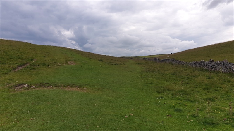
The steep rocky path up Cavedale eventually flattens out until you are walking along a path across fields. Keep following the path. When you reach a gate go through the gate. The path becomes grassy making it harder to follow. Keep going in the same direction with the wall to your right. If the grassy path seems to fork, take the path to the right and keep following it over the fields and round until you reach another gate.

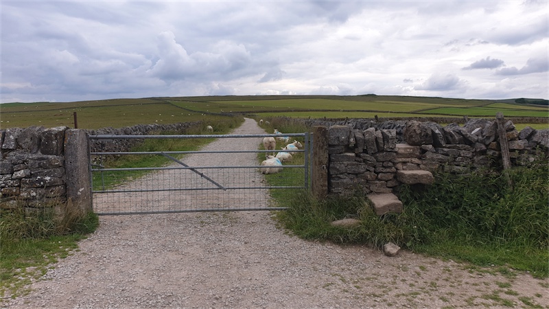
Eventually you will come to a gate, followed by another gate a short distance after. Go through both gates and then immediately turn right and go through the next gate. You should now be following a well marked trail.
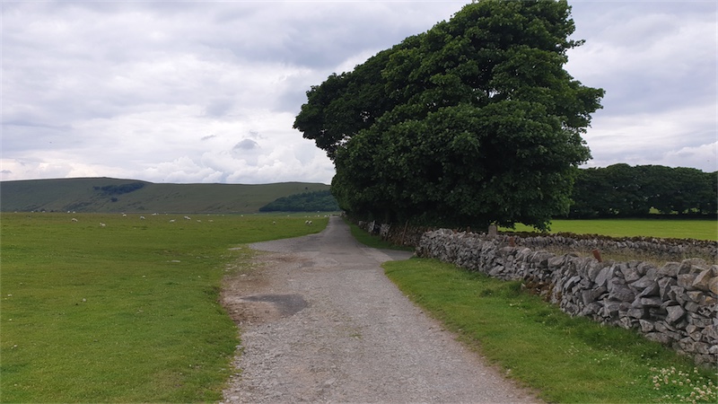

Follow the trail for around 1.6km until you get to the road. At the road you will notice a gate and a public footpath on the other side of the road. Cross the road and keep following this footpath in the same direction towards Mam Tor. The path continues to be well marked taking you around 500m across a field.


You will come to another road. On the opposite side of the road (slightly to the left) you will notice another gate and footpath that leads up the hill. Follow this footpath up the hill until you reach the laybys for Mam Tor parking. When you reach the laybys you will see a gate to your right and a steep path leading up Mam Tor. Follow this path until you reach Mam Tor trig point.

Mam Tor trig point affords an excellent view of Rushup edge, Edale, Kinder Scout, Lose Hill, Castleton and the Hope Valley. Be careful in this area. There is a section of cliff edge to the south east of Mam Tor. On Mam Tor you can also see some ancient Iron Age forts. These appear to be strange shaped bumps in the landscape and are found near the Mam Tor trig point on the west side.
Top tip: We recommend bringing good outdoor clothing. Consider waterproof and windproof layers and comfortable hiking shoes. Some sections of this route can be very exposed.


From the Mam Tor trig point keep following the path along the ridge. After around 1.3km you will come to a gate. Just before the gate turn right (sharp right almost back on yourself) and follow the small path down the hill until you reach the old road.

Turn right and walk up the old road. The Mam Tor old road is a section of road that experienced several landslides between 1974-1979. This has left the road with some dramatic cracks and sections that have entirely slipped away. It is safe to walk up the old road but be aware there are a couple of sections with big drops and cracks so take care.

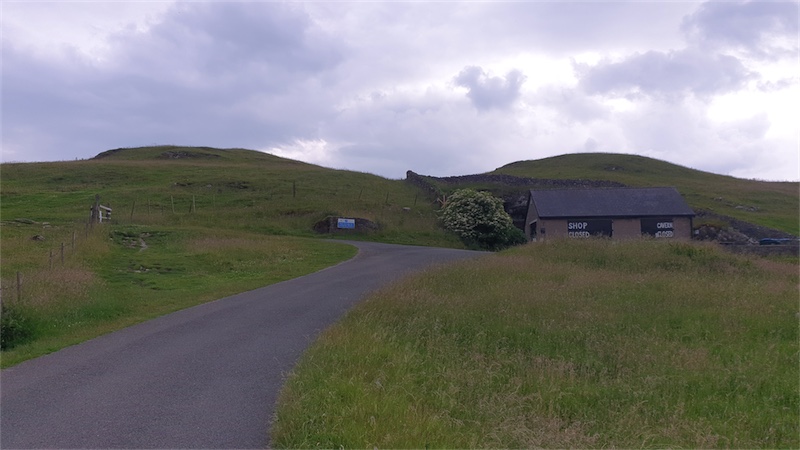
Once you reach the top of the old road walk for a short distance along the new road and keep an eye out for a left turn, which leads to Blue John Cavern. Follow this left turn. At the bottom of the hill turn left again and then turn right and walk up the grassy hill until you reach a fence and a stile.
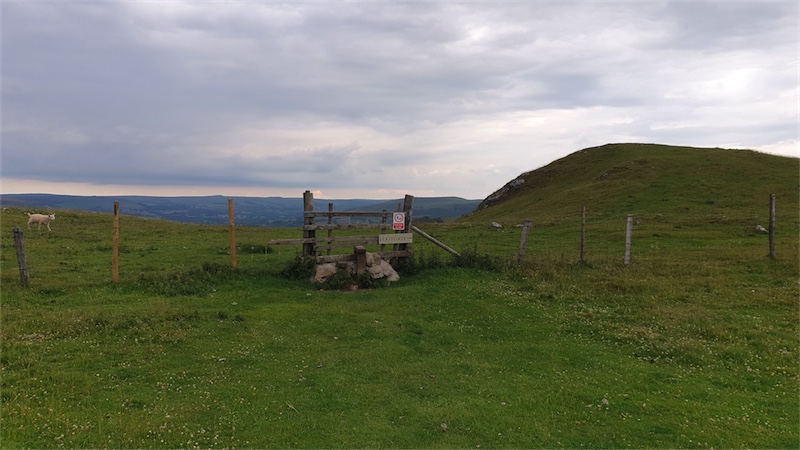

Cross the stile and turn left and walk a short distance along the ridge. To your left you will see stunning views over the hope valley. To your right you should be following the fence. Walk for around 300m until you reach a gate.
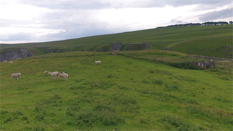

Go through the gate. You are now at the top of Winnats Pass. This is a spectacular road situated in the bottom of a deep dramatic valley. It is thought that Winnats pass was formed by ancient melting glaciers that created a deep underground river. This cave system collapsed forming a deep and impressive valley.

From the top of Winnats pass (the gate) you can either turn right and take a path that leads to the top of the Winnats Pass road. You can follow the road down the bottom of the valley. It is a steep road and can be fairly busy. You can walk along the left side of the road (as you go down). Alternatively, it is possible to walk down along the top of Winnats Pass. Take a left and follow the path down. You will get an excellent view of Winnats Pass to your right. Be careful the drop into the valley is very steep so keep a safe distance. The path leading down this side of Winnats Pass is also very steep so proceed with caution.

When you get to Speedwell cavern at the bottom of Winnats pass, cross the road and walk down past the cattle grid. There is a footpath on the right that leads back into Castleton across the fields.
A shorter Castleton walk (round route) 4.65km
The Castleton Walk route above is 10km (6 miles) which is quite a long distance for a family, especially with younger kids. Here is an alternative Castleton walk that follows a similar route but is half the distance. There is also less hill climbing on this route:
- Start at Mam Nick Carpark (or park in the layby at the start of the Mam Tor footpath).
- Walk up Mam Tor to the trig point.
- Keep walking along the ridge following the path
- Take a sharp right just before the gate and follow the small path down the hill (almost back on yourself)
- When you get to the old road turn right and follow the old road back up the hill
- When you get to the new road walk a short distance and turn left towards Blue John cavern
- Walk down the road towards Blue Jon cavern and then turn left and walk up the grassy hill.
- Cross the stile and then turn left and follow the ridge until you reach a gate at the top of Winnats Pass.
- Go through the gate and then turn right and follow the foot path accross the fields and back to Mam Nick carpark.
Ways to extend the Castleton walk
If you’re one of those crazy types and 10km isn’t enough for you, it is possible to extend the Castleton round walk. Several options are available. Rather that turning off Mam Tor ridge towards the Old road you can keep walking along the ridge until you reach Lose Hill (the final peak on this section of the ridge). You can then either return along the same route or drop down towards Hope village and then walk back to Castleton.
Other things to see and do near Castleton
If you are doing a Castleton walk we also recommend budgeting some time to enjoy Castleton village as well.
It is possible to visit and explore Peveril Castle located on the hill overlooking Castleton. To find out more check out the English Heritage website.
Castleton is home to several showcaves where you can take guided tours and explore the subterranean beauty of the limestone hills. In the area you can visit Blue John Cavern, Speedwell cavern and Peak Cavern (“The Devil’s Bum” or something like that) and Treak Cliff cavern. Keep your eye out for events at Peak Cavern such as carols in the cave and movie nights.
In Castleton village you can find pubs, restaurants, coffee shops, a fish and chip shop. There are also Antique shops and gem shops where you can buy minerals and crystals and other souveriers.
